|
The Top Ten Rivers of the World
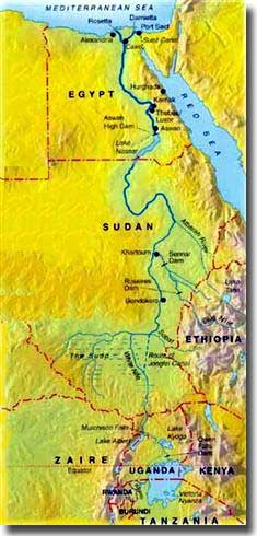
Introduction. Number 1. The Nile. It has three major rivers contributing to it, the Blue Nile with its source in Ethiopia near Lake Tana, north of Khartoum, the White Nile and Blue Nile are joined by the Atbara, which also was born in the highlands of Ethiopia. A little north of Cairo, the Nile splits into two arms, the Rosetta Branch to the west, and the Damietta to the east. In 1971 the Aswan High Dam was opened, built to control the flow of the Nile, and Lake Nasser, some 312 miles long, a man made lake came into being as a result of this construction work. Salt water problems.
Map of the Nile River
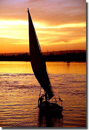
Sunset on the Nile River
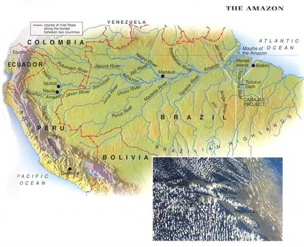
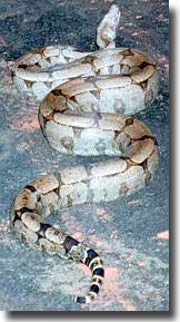
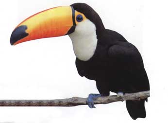
The basin formed by the Amazon is 9 times the size of the US state of Texas, and its water shed covers the largest tropical rain forest world wide. I was suprised to learn that not a single bridge spans this mighty river. Many species of unique animals, birds, fish, and plants grace the lands that the Amazon passes through on its way to the Atlantic Ocean. The Toucan with its amazing beak, is found no where else but close to this river, the boa constrictor flourishes in the damp rain forest ajoining the river, and the jaguar may be seen stretched out in tree branches as the river flows swiftly by. Whilst in America they may boast of catfish up to 40 pounds in weight, a typical catfish of the Amazon may come in at 200 pounds. The mere mention of the Amazon brings to mind, size, exotic plants, dripping rain forest, adventure, mystery, and a sheer volume of rushing water probably unequalled anywhere else on our planet.
Map of Amazon River
The boa constrictor of the Amazon area
The Toucan only found in the environs of the Amazon River
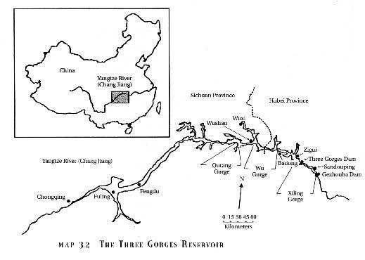
Three Gorges Dam project. Deposit of Silt. Population along the banks of the Yangtze River.
The Yangtze River and the Three Gorges Dam location
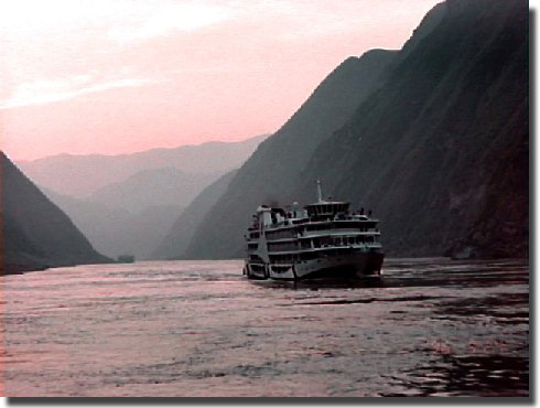
A view of the Yangtze River
Bridge across the Yangtze
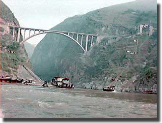
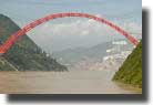
The Rainbow bridge at Wusan, situated athe end of Wu Gorge, the second of the three gorges on the Yangtze River
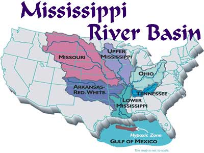
Indian name for Mississippi. History of the River.
Mississippi River basin Number 5. The Irtysh River. The river's name Irtysh means "earth mover", and prior to the Russians arriving in the late 16th. Century, its environs were occupied by both Chinese and Mongels. Along its banks before reaching Omsk are large power stations devouring vast quantities of the river's water to operate them. The river then moves through the Kazakhstan steppes.
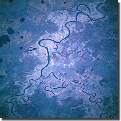
Satellite image of the Irtysh River in Russia
Map showing the Irtysh River, and it flowing into the Ob
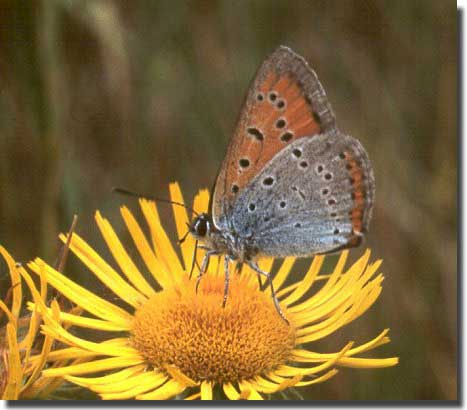
Butterfly from the left floodlands of the Irtysh River near the city of Omsk. Photo by Oleg.Hosterin
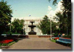
City Administration Building of Omsk, sits on Irtysh River
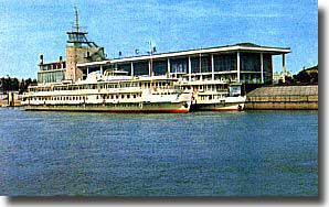
Omsk Passenger River Terminal
Number 6. The Amur River. For almost 1,100 miles it marks out a common boundary with China on its right bank, and Russia on its left bank. I sat wondering if sharing a major river between both China and Russia posed any problems, are there disputes over the fish in the Amur? of which there are some 108 different species. One of them is the Black Amur, a fish that may grow to 120 cm, and weigh in at 30 kilograms. There is not a single dam to be found over the total length of the Amur river, but does access to its water provide friction between the neighbours who share this bounty? Do China and Russia cojoin to preserve its assets? The area in, and close by this river, is home to 95% of the world's Oriental White Stork. As the river wends its way across NE Asia through a variety of landscape, on its journey to to the sea, the valleys, drained by it and its branches, embrace some 715,000 square miles. Amur Leopard Cat.
Map showing the course of the Amur river
A picturesque view of the Amur river
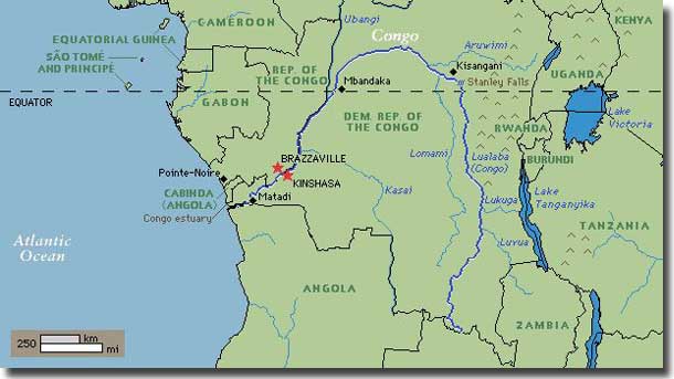
The river is a major highway in the area, carrying barges loaded with fuel, copper, wood, minerals, palm oil, and agricultural products. It is also Africa's greatest potential source of hydroelectric power, and the Inga Power project is the first to exploit this possibility. The Congo traverses a rain forest that is second only to that of the Amazon. Some 4,000 islands dot the river within its banks, over its long journey down to the Atlanic Ocean, some up to 10 miles long. The countries that the river passes through are: The Democratic Republic of Congo, The Peoples Republic of Congo, The Central African Republic, Zambia, Angola, Cameroon, and Tanzania. On hearing the name Congo River, it summons up in my mind, Africa, Stanley and Livingstone, the mighty Victoria Falls in Zimbabwe, the Dark Continent, and its history of Black Slavery.
Map of Congo River
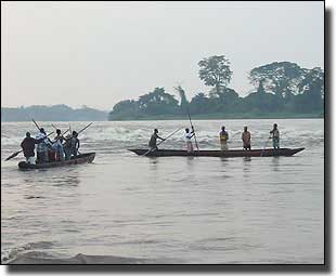
Wooden canoes still in use for fishing on the Congo River
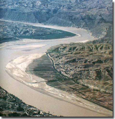
Length 2,700 miles. Location China. Empties into the Gulf of Chihli. The Yellow River, is the northern most of the major rivers in China's Yellow River basin. It is said to be the cradle of China's civilization, and covers three major regions, the upper, the middle, and the lower. Source. Hydro electric Projects. In its lower reaches, the river is confined by levies lining its banks to prevent flooding. Every year 1.6 billion tons of sand are washed into the Yellow River, and this soil erosion causes great harm to all the people living within the reach of this great river. At its estuary, the river dumps a billion tons of sediment into Bohai Bay.
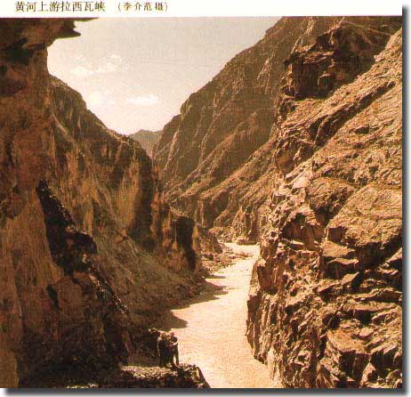
The Yellow River pasing through Laxiwa Gorge
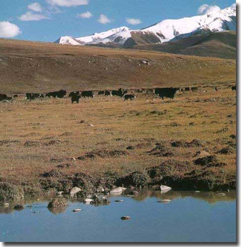
The Bayankala Mountians. The source of the Yellow River is a basin at the foot of these mountains.
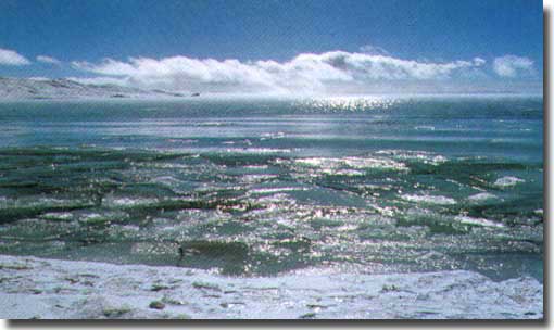
Eling lake in winter, shimmering with ice
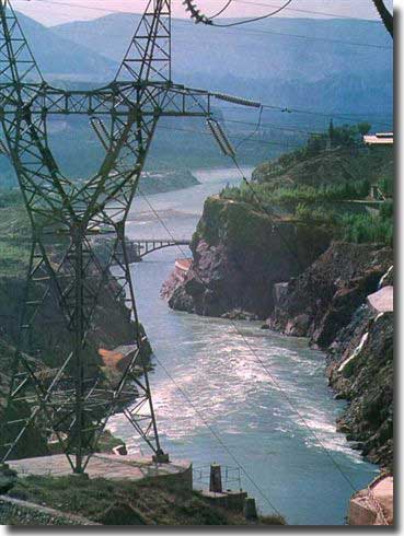
Hydro power works in Liujiaxia Gorge to suppy power to the city of Lanzhou
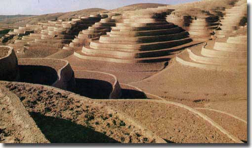
Terraces built over the Loess plateau
The river flows through Shanxi province on its right, and Shaanxi province on its left
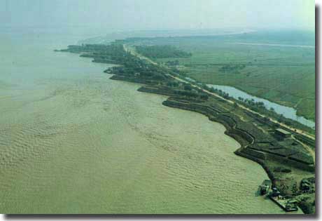
Levee banks at Kaifeng. Built to overcome the flooding prone to the Yellow River
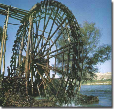
An ancient waterwheel in an area vastly eroded and in the category of wastelands, caused by past flooding of the Yellow River
Home to wild life.
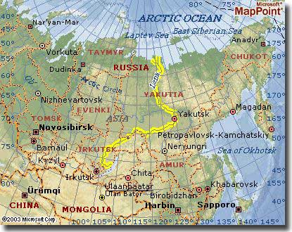
Map of Lena River, Russia
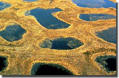
Polygon Ponds at the Delta of the Lena River. Photograph by Hartmut Jungius
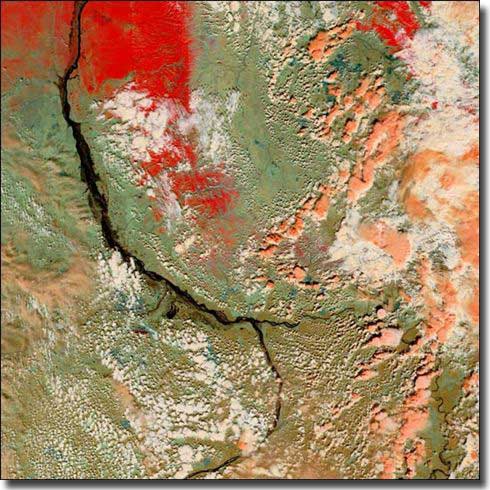
Flooding on the Lena river. The Delta covered in ice shows as red, the River would normally show as a black line, with land areas dull green or tan.
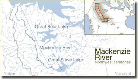
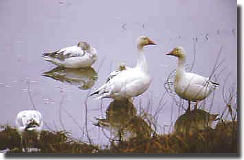
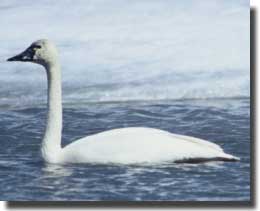
It was named after the early explorer Alexander Mackenzie who, in 1788 believed he was following a river route to the west coast, but it led to the Arctic ocean. The large delta provides a habitat for Snow Geese and Tundra swans, and many types of water fowl.
Map showing the Mackenzie River, flowing north to the Arctic
Snowgeese found on the Mackenzie River
The Tundra Swan found on the Mackenzie River
|